
Drone Surveys for Buildings and Sites
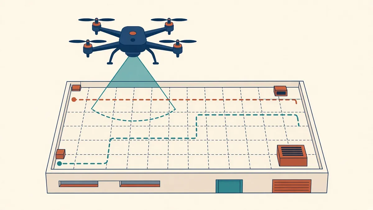
Drones can reach roofs, facades and sites that are slow or risky to survey on foot.
Drones can capture roofs, facades and sites quickly from the air. For Architects, they're useful for site context, roof surveys and photogrammetry. Their use is regulated, so surveys need planning.
Uses
- Site photographs and context
- Roof condition surveys
- Aerial photogrammetry
- Topographic information, when combined with control points
- Progress monitoring during construction
Outputs
- Photos and video
- Orthomosaics
- Point clouds and meshes
- Digital surface models
Regulations
Drone rules vary by country and can change, so check current requirements before any flight. Examples include:
- US: commercial operations generally fall under the FAA's Part 107 rules, which include pilot certification
- UK: the Civil Aviation Authority sets the rules, including registration and operating categories
- UAE: the General Civil Aviation Authority and local authorities regulate drones, and permissions may be required
Many projects use licensed drone operators to manage compliance.
Restricted areas
Airspace near airports and sensitive sites may be restricted. Check maps and permissions.
Privacy
Drone surveys can capture neighbouring properties and people. Follow privacy rules and inform neighbours where appropriate.
Planning a survey
- Define what you need to capture
- Check regulations and permissions
- Plan flight paths and overlap
- Place ground control points if accuracy is needed
- Check weather conditions
Accuracy
Accuracy depends on camera, flight height, overlap and control. Ground control points or RTK positioning improve accuracy.
Combining with other methods
Drone data is often combined with ground laser scanning, giving full coverage of roofs and interiors.
Safety
Using results
Orthomosaics and point clouds can be used as backgrounds for drawings and models.
Using a licensed operator
Many practices hire specialist operators, who hold the right permissions and insurance and know local rules. Give them a clear brief covering the area, outputs, accuracy and timing.
Data handling
Store raw images and processed outputs together, with flight details. Share only what's needed, especially if images show neighbouring properties.
Weather and timing
Wind, rain and low light affect safety and image quality. Allow flexibility in the programme for weather.
- 01Uses
- 02Outputs
- 03Regulations
- 04Restricted areas
- 05Privacy
- 06Planning a survey
Checking outputs
Compare a few points in the drone outputs with measured site points. It confirms that scale and position are right before anyone draws from the data.
Planned carefully, drone surveys provide useful information safely and within the rules.
If your team needs extra production capacity for work like this, take a look at our Architectural production services, or tell us about your project.
Related articles

Photogrammetry for Architecture
Building 3D models and orthophotos from overlapping photographs.
Read more →
Measured Building Surveys Explained
Survey methods, deliverables and how to specify what you need.
Read more →
Site Analysis Basics for Architects
Context, climate, access and constraints, mapped before design.
Read more →